
Live Updates: Snow and ice blanket central NC

A winter storm brought snow, sleet, and freezing rain to the Triangle on Saturday night and Sunday morning. While power outages during Sunday and Monday morning weren't as high as feared by some forecasters, dangerous driving conditions remained a threat Monday as forecasters predicted very cold temperatures.
The National Weather Services predict the coldest temperatures will come following the storm and hit Monday night in to Tuesday morning, bringing dangerously cold air.
Power outages are shown here and are updated every 30 minutes.
ReadyNC also lists what supplies to stock up on, especially if you lose power.
Duke Energy warns customers of a scam going around
Duke Energy is warning customers about a scam going around in the form of a text message. The message claims that a power outage is scheduled in the receiver's area. Duke Energy says this message is not from them, and that customers should avoid unknown links and attachments they receive via text.
⚠️ Beware of a scam falsely claiming a scheduled power outage. This message is NOT from Duke Energy. Avoid unknown links or attachments. Contact Duke Energy directly or check official channels for accurate grid and account information. pic.twitter.com/qGGQnSWGzR
— Duke Energy (@DukeEnergy) January 26, 2026
Wake and Durham to close emergency shelters but white flag shelters will remain open
Updated 3 p.m. to reflect the scheduled closure of the shelter at Smith Middle School in Chapel Hill.
With the snow and icy weather winding down, emergency shelters in Wake and Durham counties are planning to close.
Wake County
The shelter Heritage High School in Wake County will close Monday at noon, and they plan to transport folks still needing shelter to other facilities. The shelter at Southeast Raleigh High School will close Monday at 4 p.m.
White flag shelters in Wake County will remain available. Second Street Place on 5010 Second Street in Raleigh is open to adults and the Salvation Army on 1863 Capitol Boulevard can accommodate families. More info on Wake County's shelters here.
Durham
In Durham, the mass care shelter at Northern High School will no longer be taking any more people or pets after noon Monday. However, the city's white flag shelters remain open and those needing shelter can call Entry Point at (984) 287-8313. More info can be found here.
Orange County
Orange County will close the shelter at Smith Middle School Tuesday at 12 p.m. The school is located at 9210 Seawell Road in Chapel Hill, and those needing transportation to the facility should call (919) 245-6111. Information on Orange County's white flag shelters can be found here.
PHOTOS: City of Durham responds to the winter storm
Over the weekend city workers in Durham were out in the community responding to the winter storm.
Photos courtesy of City of Durham.


Trash collection schedules shift due to icy conditions
Triangle residents have had their curbside trash and recycling collections adjusted this week due to the winter storm.
Wake County has closed all non-essential services including solid waste. Solid waste service in the central business district of Raleigh has also closed Monday.
Curbside trash collections in Durham are canceled and will resume Tuesday morning. Chapel Hill trash collections are also canceled Monday.
Highway patrol report more than 600 collisions, but no fatalities this weekend
The North Carolina State Highway Patrol says there have been 630 collisions since the start of the winter storm as of Sunday night.
State troopers have also responded to an additional 683 calls for service across the state during the storm.
Officials say have been no fatal crashes associated with the storm.
Dangerously cold air temperatures expected Monday

Power outages remained low across the Triangle on Monday morning, but the National Weather Service still warns of dangerous driving conditions and many roads across the Triangle were covered with ice Monday morning.
Those conditions are not likely to improve much on Monday as bitter cold air is expected to arrive throughout the day. Temperatures will drop in to the teens with wind chills in the single digits and even approach 0 degrees Monday night and Tuesday morning.
Nick Petro is a meteorologist with the National Weather Service in Raleigh. He says people should be vigilant of trees Monday.
"Very loose trees that kind of got weighted down by the ice on Sunday and Saturday night, any type of branches that may be cracked but haven't fallen off yet, that's what we need to watch out for," Petro said.
Later tonight and tomorrow, black ice will be a concern on the roads from leftover moisture refreezing. Black ice can be difficult to see and can cause severe accidents.
More freezing rain and sleet expected Sunday night

Power outages remained low in the Triangle on Sunday afternoon, but forecasters with the National Weather Service say residents should continue to stay vigilant as a second wave of this major winter storm is expected overnight.
The second wave of the winter storm will reach the Triangle is expected to bring up to a quarter of an inch of additional ice accumulation along a diagonal line across much of the state that cuts from Pittsboro through Raleigh to Roanoke Rapids.
Less accumulation is expected east of that line.
Meteorologist Nick Petro of the weather service says the effects of ice on trees and power lines could be magnified Monday by winds rising in the daytime to 10-to-15 miles per hour, with gusts up to 25 miles per hour.
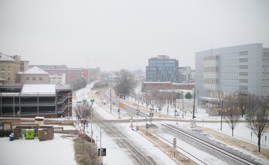
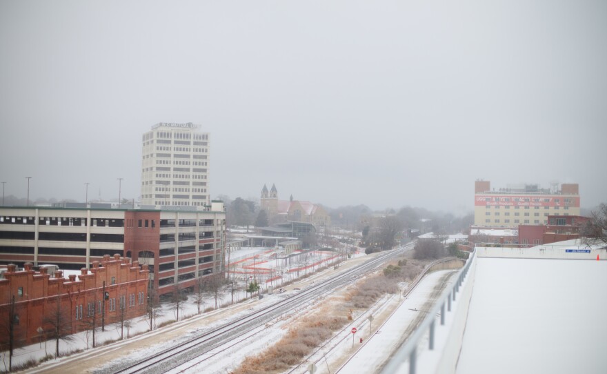
Photos: Durham largely empty as snow and ice blanket the city
Snow and ice covered downtown Durham on Sunday, leaving most - though not all - residents to stay home.
Photos by Peyton Sickles for WUNC.


Local governments across central NC to close Monday

Government offices across the region have announced closures Monday due to severe winter weather.
Orange County officials say two senior centers, solid waste and recycling centers, parks, and libraries will be closed.
In Durham, all city facilities will be closed to the public on Monday. And in Wake County, all non-essential county operations will be closed.
GoTriangle will also suspend services on Monday, due to dangerous road conditions. Officials say extremely cold temperatures will continue, creating prolonged unsafe conditions.
Photos: Snow day fun
Residents around the Triangle took to snow covered streets, yards, and hills on Sunday.
Photos by Kate Medley


Power outages still low in Triangle but Duke Energy says crews are on standby
Duke Energy says it moved 18,000 workers into the Carolinas ahead of the winter storm to respond to power outages. About 800 of them are standing by at a staging area in Raleigh.
By Sunday afternoon, nearly all residents throughout central North Carolina still had power, but forecasters predicted more sleet and freezing rain by Sunday evening, which could lead to more widespread power outages.
Spokesman Jeff Brooks says the crews will begin restoring power as soon as it's safe to do so.
"This is part of our commitment to bring in resources ahead of the storm: Get equipment, track vehicles, bucket trucks, aerial vehicles, all kinds of things that we can do to help restore power when roads are going to be challenging."
In western North Carolina, more households had lost power by Sunday afternoon, with more than 9,000 customers without power in Transylvania County at about 1:30 p.m.
Buddhist monks continue 'Walk for Peace' in Raleigh despite ice
Icy conditions didn't stop the Buddhist monks' "Walk for Peace" in Raleigh on Sunday morning.
The group said in a social media post that they continued to attract supporters and onlookers as they walked from near downtown Raleigh to a lunch stop at the Van-Hanh Pagoda on Forestville Road in North Raleigh.
The monks are making their way from Texas to Washington, D.C.
Schools, universities canceling in-person classes Monday
Many schools and universities around the Triangle are canceling in-person classes for Monday due to the winter storm.
UNC-Chapel Hill and NC State won't hold classes Monday, nor will Durham Tech and Wake Tech.
Franklin and Johnston county schools will be closed Monday. Wake County and Durham Public Schools will have remote instruction. Students in Chapel Hill-Carrboro have a teacher workday scheduled for tomorrow.
Other local school districts are expected to announce their plans later Sunday.
NWS: Triangle ice and power outages could be less severe than earlier predictions
The National Weather Service says central North Carolina could see less ice and fewer power outages than forecasters initially feared.
Meteorologist Jonathan Blaes says the Triangle could see up to 0.2 inches of freezing rain before the winter storm ends tonight. That's less than the amount that creates the risk for widespread power outages.
“It has decreased, but is not zero,” Blaes said Sunday morning. “So we're not saying all clear, but certainly the risk of an ice storm, a crippling kind of scenario, does not appear to be in the offing for most of us. We're not out of the woods – refreeze and black ice Monday night, especially Tuesday morning, is there.”
Blaes says that while power outages may be isolated, road conditions could remain icy for several days.
The lower freezing rain totals are occurring because there have been breaks in precipitation, and more of it has fallen as sleet or snow as of Sunday morning.
As of mid-morning Sunday, the Triangle had received about 0.2-0.4 inches of snow and sleet and about 0.1 inch of ice accumulation.
Blaes says another wave of precipitation will come through the area in the late afternoon and evening hours, but slightly warmer temperatures could mean some of it falls as non-freezing rain.
“There'll be a period where it is coming down pretty hard, and that line will move from west to east during the dinnertime hours,” he said.

North Carolina National Guard responds to the winter storm
Yesterday the North Carolina National Guard mobilized resources across eastern, central, and western North Carolina in preparation to assist Emergency Management during the winter storm.
As of yesterday morning, the National Guard has activated approximately 454 personnel and employed 179 vehicles. This includes vehicles capable of traversing hazardous conditions to augment emergency responders, distribution teams to provide critical supplies to staging locations, and maintenance and recovery teams capable of assisting the Department of Transportation.
Since Hurricane Helene. the National Guard has also started prioritizing North Carolina’s digital infrastructure during natural disasters.
“Threat actors will take advantage of individuals and organizations during winter storms. You are more likely to click on text messages or emails that talk about news that’s currently happening around you,” said Sharon Atkins, a Cyber Threat Intelligence Analyst with the North Carolina National Guard Cyber Security Response Force. “They know that people are in a vulnerable situation. Emotional stress can be high; power can be down.”
Where to find shelter in the Triangle
Counties across the Triangle have shelters open Sunday for residents impacted by the ice storm. Most of the shelters are allowing pets and encouraging people to bring necessities like prescription medication, extra clothes and cash.
Here's a look at where to go in each county:
Wake County: Shelters are at Heritage High School in Wake Forest (1150 Forestville Road) and Southeast Raleigh High School (2600 Rock Quarry Road). More information is available here.
Durham County: A shelter is open at Northern High School, 4622 N. Roxboro St. (guests should follow signs to the main gym). Cots, meals, showers, phone charging stations and pet kennels will be available. More information is available here.
Orange County: In Chapel Hill, a shelter is open at Smith Middle School (9201 Seawell School Road) with free rides available from the Passmore Center in Hillsborough. People needing a ride should call 919-245-6111. "We will not ask for proof of citizenship or identification to enter a shelter," the county said. "The shelter will have food, water, and basic necessities, but will not have easy access to medications or many other personal items." More information is available here.
Johnston County: A "White Flag" shelter is available at the Smithfield Recreation and Aquatics Center, 600 M. Durwood Stephenson Parkway. More information is available here.
Chatham County: Chatham had not announced any shelter plans as of Sunday morning.
Franklin County: The Franklin County Department of Social Services and Health Services lobby at 107 Industrial Drive, Louisburg, is open as "a last resort option shelter for those who lose heating ability in their residences. This location has limited space and limited food and should only be used as a very last resort for those in true need," the county says on its website.
https://www.wunc.org/term/news/2026-01-25/where-to-find-shelter-triangle-winter-storm
NC State Highway Patrol reports more than 200 crashes overnight
The State Highway Patrol says it has responded to more than 200 crashes overnight through 6 a.m. Sunday due to the winter storm. None of them involved fatal injuries.
The agency urges drivers to stay off the roads Sunday if possible and drive below the posted speed limit. Some roads are being closed due to icy conditions, including the Neuse River bridge in New Bern.
Cannot stress this enough. It's not a good day to test the roads - at all.
— NCDOT (@NCDOT) January 25, 2026
Already we're seeing crashes being reported and Neuse River Bridge near New Bern has closed.https://t.co/AGDVnBcrXk can help you decide to stay home.
(📸 : US 421 near Boone and I-85 at Falls Lake) pic.twitter.com/TWu4iDibRW
"If you choose to drive in the conditions that we anticipate will impact our roads, you are rolling the dice with poor odds," Transportation Secretary Daniel Johnson said during a news conference. "The risk of crashing in these conditions is high, which can lead to serious injury or being stranded in a disabled vehicle in bitterly cold conditions."
Johnson says road conditions will remain icy even after freezing rain ends. More than 2,000 Department of Transportation employees will be working in the coming days to clear the roads.
Duke Energy says 18,000 crews are ready to tackle power outages
Duke Energy says it moved 18,000 workers into the Carolinas ahead of the winter storm to respond to power outages. About 800 of them are standing by at a staging area in Raleigh.
Spokesman Jeff Brooks says the crews will begin restoring power as soon as it's safe to do so.
"This is part of our commitment to bring in resources ahead of the storm: Get equipment, vehicles, bucket trucks, aerial vehicles, all kinds of things that we can do to help restore power when roads are going to be challenging and conditions very tough in the wake of this significant ice event," Brook said. "It's great to see these reinforcements, and we welcome their help."
As of 8 a.m. Sunday, about 250 customers were without power in southern Wake County but otherwise few outages had been reported in the Triangle. More outages are likely as ice totals increase.
In addition to Duke, Electricities — which manages municipal electric systems in towns like Wake Forest and Smithfield — has deployed mutual aid resources from Ohio, Minnesota and Nebraska to support its efforts.
A mix of snow/sleet, and freezing rain makes its way through central NC
NWS reports that a mix of snow/sleet and freezing rain has made its way through Central North Carolina This will continue for the next several hours with the steadiest precipitation being along north of I-85.
NWS advises people to not travel right now unless it is absolutely necessary.

President Donald J. Trump Approves Emergency Declaration for North Carolina
FEMA announced last night that federal disaster assistance is available to the state of North Carolina to supplement response efforts due to emergency conditions resulting from a severe winter storm that began on January 21.
These actions authorize FEMA to coordinate all disaster relief efforts to alleviate the hardship and suffering caused by the emergency on the local population and to provide appropriate assistance to save lives, to protect property, public health and safety and to lessen or avert the threat of a catastrophe in all 100 counties, the Eastern Band of Cherokee Indians and the Lumbee Tribe of North Carolina.
Specifically, FEMA is authorized to identify, mobilize and provide, at its discretion, equipment and resources necessary to alleviate the impacts of the emergency. Emergency protective measures, limited to direct federal assistance, under the Public Assistance program, will be provided at 75% federal funding.
DuWayne Tewes has been named the Federal Coordinating Officer for federal response operations in the affected area. Designations may be made at a later date if requested by the state and warranted by the results of further damage assessments.
RDU says 85% of Sunday's departing flights have been canceled; most airlines have ceased or reduced flight operations
As of 6 p.m. on Saturday, about 85% of flights that were scheduled to depart on Sunday from RDU International have been canceled.
RDU spokesperson Stephanie Hawco said in an email to WUNC that of the 187 flights scheduled to depart on Sunday, 159 have been canceled, and those numbers could change later this evening.
Hawco added that most of the airlines have stopped or reduced flight operations. United, Southwest, Spirit and Frontier are among the airlines that have ceased flying.
UNC-Chapel Hill declares campus state of emergency
UNC Chancellor Lee Roberts has declared a campus state of emergency starting Saturday afternoon until Tuesday.
The declaration also restricts personal vehicle use on campus between the hours of 8 p.m. through 6 a.m. each night to help keep the roads clear for emergency vehicles.
University officials urge students to stay at home to ensure safety and space for first responders to move about campus to attend to any emergencies. UNC-Chapel Hill has set up a winter weather resources page to help provide information about campus facilities and services during the storm.
Wake County opens two emergency shelters

Two emergency shelters are now open in Wake County ahead of this weekend's winter storm.
They are located at Southeast Raleigh High School at 2600 Rock Quarry Road in Raleigh and Heritage High School at 150 Forestville Road in Wake Forest.
County officials advise folks heading to the shelters to bring the following:
- Prescription medications
- Special needs items, such as eyeglasses, contact lens solutions, hearing aid batters
- Extra clothing
- Food and items for infants and young children
- Cash
- Food and items for pets, if bringing them
Wake County also advises community members to sign up to receive ReadyWake emergency alerts, which can be sent by email, phone or text. Folks who have non-emergent questions or issues can contact the Wake County emergency operations center at 919-856-7044.
Gov. Stein: "It's about time to stay put" as winter storm moves in
North Carolina has requested and received an emergency declaration from the federal government ahead of a winter storm, Gov. Josh Stein said Saturday.
The declaration will provide state officials with additional generators to send to hospitals and other critical facilities and tap U.S. Forest Service assets to clear trees that are expected to fall under accumulated ice, among other assistance.
"We are grateful for the partnership of the federal government and its quick approval of our request," Stein said.
Stein made the announcement during a briefing Saturday morning, as winter weather conditions begin to reach the western part of the state. Forecasters are predicting that as much as four inches of snow and sleet could fall in the mountains and in the northwestern part of the Piedmont region.
With wintery precipitation already falling around places like Robbinsville and Waynesville, Stein said, "Depending on where you live, it's about time to stay put. Please do not be out on the roads unless it is absolutely necessary."
Ice accumulations are of particular concern because of the damage it could cause to the state's power distribution system, both in the form of falling trees and, if there is enough, by knocking down power lines and poles.
"We anticipate severe disruptions to critical infrastructure, including roadways, emergency communications, and utility systems. Significant and widespread power outages are expected across the state, increasing the risk of injury or death—particularly among vulnerable populations," Stein wrote in his letter to President Donald Trump requesting the emergency declaration.
For the full update from this briefing, read the full story here.
Latest forecast shows sleet to start Saturday night

Sleet, freezing rain, and ice accumulation is expected to begin in parts of central North Carolina on Saturday evening, according to the latest forecasts by the National Weather Service.
A winter storm warning continues to be in effect for most of central North Carolina. The heaviest impacts are expected along the U.S. Hwy 1 corridor and areas directly west. That includes much of the Piedmont, but significant ice accumulation is possible in other areas as well, including up into the Triangle.
Bitterly cold temperatures are expected in the early part of the work week.
What weather apps sometimes miss about dangerous winter storm conditions

Smartphone weather apps that summarize their forecasts with eye-popping numbers and bright icons may be handy during mild weather, but meteorologists say it's better to listen to human expertise during multi-faceted, dangerous winter storms like the one blowing through the U.S.
The multistate storm's combination of heavy snow, treacherous ice and subzero temperatures shows why it's best to seek out forecasters who can explain its nuances via local TV or radio newscasts, online livestreams or detailed websites, said meteorologists interviewed by The Associated Press. The data is changing rapidly before and during the storm, and the distance of a few miles can mean the difference between snow, sleet or dangerous freezing rain.
"Weather apps are really bad at storms that have multiple types of precipitation and it really makes messaging hard," said University of Georgia meteorology professor Marshall Shepherd, a past president of the American Meteorological Society. "Apps don't understand the details of why snow, sleet or freezing rain happens."
University of Oklahoma meteorology professor Jason Furtado and other experts said humans are important in these cases, especially those with local expertise.
"For extreme weather events, it is especially important to know there are human forecasters interpreting the data and making the best localized forecasts for your area," Furtado said. "Unfortunately, many of the weather forecast apps use AI methods to either make the forecast or 'interpolate' from larger grids to your hometown, introducing the potential for significant errors."
But some apps can be useful, especially those that pair National Weather Service data with meteorologists' expertise, forecasters said. And they are definitely getting used right about now.
The Weather Channel app, which is seeing booming traffic this week, uses numerous models, data sources, weather observers and staff, said James Belanger, vice president of its parent company, which also owns the Weather Channel and weather.com. That level of proficiency matters, he said.
"It's an all-hands-on-deck kind of approach that we take," Belanger said, adding that "not all weather apps are created equal."
What apps can and can't do
Apps get much of their information from the National Weather Service and some companies augment it with proprietary information and the well-regarded European forecast models. Many offer forecasts by ZIP code or geographic areas far from weather stations by using software that focuses broader regional forecasts to where the phone is located.
While there are good apps, especially those displaying National Weather Service warnings and information, many "oversimplify uncertainty and present highly precise-looking numbers that imply more confidence than actually exists," said Northern Illinois University meteorology professor Victor Gensini. This type of storm is where apps are weakest because they don't get nuances, he said.
Weather apps are good for forecasting nice warm summer days, but not days like much of the country is facing now, said Steven DiMartino of NY NJ PA Weather. The paid online subscription service touts its human expertise with the slogan "Meteorology Not Modelology."
"The problem with the weather app is that it just provides data, but not explanation," DiMartino said. "Anyone can look at data, but you need a meteorologist, you need that human touch to look at it and say, 'Hmm, that looks like an error; we're gonna tweak this.'"
Seeking quality sources of data
Cory Mottice, a National Weather Service meteorologist since 2014, developed the app EverythingWeather, which uses weather service data, as an easy place for the public to find the latest weather forecasts for their area without navigating the agency's website. He said it's "just for fun" and not affiliated with the weather service.
The strength of his app, he said, is that the information comes from professional meteorologists at the more than 125 weather service offices. Many apps just use raw computer modeling data – which aren't always reliable in extreme events — with no human oversight, "which can really lead to some very misleading numbers or graphics depending on what you're at," he said.
With his approach, "you have actual meteorologists that are experts in their field at different places all over the country for that specific area, looking at the data, adjusting it, making the forecast as needed," Mottice said.
Mixing decades of experience, 100 meteorologists and AI
The popular Weather Channel app uses information from many sources, including the weather service and more than 100 weather models, including those from the U.S. and Europe and their own distinct model. They augment it with input from over 100,000 citizens to help forecast weather events, said The Weather Company's Belanger. And it's all synthesized by artificial intelligence to come up with a forecast, he said.
That's more accurate than relying on a single model or provider, he said, because AI is able to learn which models are the most accurate in different conditions to help "create that optimal forecast."
Even so, humans, including a team of more than 100 meteorologists, always have the final say about what goes on the app, Belanger said.
"One of the things that has been a lesson and a principle that we've adopted is that it's the combination of advancements in technology with the human oversight," that allows the company to provide the best forecasts — especially in situations like the current winter storm, Belanger said.
Be careful with social media
Forecasters also warn against another quick fix for weather information: social media, where hype, misinformation and short takes can spread quickly.
While social media can help amplify official sources like the weather service, "it's also where misinformation spreads fastest," Gensini wrote in an email.
"Weather is complex, and social media tends to reward confidence and drama, not nuance," Gensini said. "That mismatch is a real challenge during major events like this."
Kim Klockow McClain, an extreme weather social scientist at the University Corporation for Atmospheric Research, said people are "getting misled by hyped forecasts."
"When people are continually exposed to only worst-case forecasts, research suggests they will lose trust over time," she said.
__
Borenstein reported from Washington, Webber from Fenton, Michigan.
___
The Associated Press' climate and environmental coverage receives financial support from multiple private foundations. AP is solely responsible for all content. Find AP's standards for working with philanthropies, a list of supporters and funded coverage areas at AP.org.
Information you need to know ahead of this weekend's winter storm
Forecasters are predicting a major winter storm this weekend, bringing snow, sleet and freezing rain to North Carolina from Saturday through Monday. Find a more detailed breakdown of how to prepare here.
Here's what you need to know:
To best prepare, the State of North Carolina recommends stocking up a seven-day supply of non-perishable food and a gallon of water for each person per day. Officials also recommend having flashlights and batteries, warm blankets and layerable clothing, a portable radio, supplies for pets, fire extinguishers and snow shovels.
Icy weather conditions can also cause major power outages and cause road conditions to quickly deteriorate. You can find updated information about snow and ice, incidents and road closures at https://drivenc.gov/ and track power outages at readync.gov where updates are posted every 30 minutes.
State officials have stressed the importance of staying off of the road during the storm, especially because ice can melt and refreeze throughout the weekend. If it is absolutely necessary to drive, be sure to clear snow and ice off of your car’s windows, headlights, roof and hood. State emergency officials also recommend keeping a disaster kit and extra warm clothes in the vehicle, and giving yourself more time than usual so that you can take it slow.
If you or others are in need of shelter, The United Way runs a free and confidential statewide hotline with information about emergency shelters and health services in their communities. You can call 211 or visit their website at nc211.org.
Due to the threat of carbon monoxide poisoning, the North Carolina Department of Health and Human Services cautions people against using gasoline-powered generators or tools, outdoor grills and camp stoves in enclosed spaces. Health officials also warn against letting vehicles idle in the garage, using charcoal grills or propane stoves indoors and using a stove or other gas appliances to heat your home.
Shows and events around the Triangle that have been postponed or canceled
Below is a list of concerts and other events that have either been postponed or canceled due to this weekend's winter storm.
Kings
1/24 -The Great Cover Up - Night 2 [Rescheduled for 3/14/2026]
1/25 - Shattered Realm [CANCELED]
Cat's Cradle
1/24 - The Still Not Okay Tour [Rescheduled for 3/27/2026]
1/24 - Greg Freeman [CANCELED]
The Pinhook
1/24 - The Conjure presents Body Roll [CANCELED]
Rubies on Five Points
1/25 - Zones [Rescheduled for a later date, TBD]
Bitter Social Raleigh
1/24 - NO VISA: Hip Hop Is Dance Music [Rescheduled for 3/7/2026]
Carolina Performing Arts
1/23 - Music & Mind [CANCELED]
1/24 - Renée Fleming in Recital [CANCELED]
RDU International plans to stay open this weekend
Raleigh-Durham International Airport plans to remain open during this weekend's winter storm.
A spokesperson for the Raleigh-Durham International Airport says they'll remain open even if one or more runways are closed. The airport's snow removal crews will be working around the clock prior to and during the storm.
Orange County to open public shelter Saturday morning

Orange County will open a public shelter for residents affected by the winter storm starting Saturday morning. The shelter is located at Smith Middle School on Seawell School Road in Chapel Hill.
Orange County officials say the shelter is open for anyone who is in need and they will not ask for proof of citizenship or identification to enter.
Those who come to the shelter should bring prescription and emergency medications, extra clothes, and hygiene supplies.
Pets are welcome, but may be housed in a separate area from their owners. Residents must bring proof of up-to-date vaccination lists for each pet.
NWS upgrades winter storm watch to a warning to parts of central NC; Gov. Stein advises North Carolinians to prepare to stay indoors for several days

Forecasters have now upgraded the "winter storm watch" to a "winter storm warning" for parts of central North Carolina, starting Saturday afternoon heading into Monday.
While it's mainly in the Triad area, it also covers some areas in the Triangle, like Chapel Hill and Hillsborough. A winter storm watch still remains in effect for other parts of the region.
Meteorologists say heavy mixed precipitation is expected, and sleet and snow could reach up to three inches. A swath of North Carolina from Charlotte running northeast beyond Wake County to the Virginia state line is expected to see between 0.6 and 0.75 inches of ice accumulation.
"If that worst case scenario happens, then clearly there's going to be more power outages, more widespread, more prolonged, more long, lasting impacts for several days in terms of power outages, tree damage and travel impacts," said Nick Petro, a National Weather Service meteorologist in Raleigh.
As of Friday morning, the N.C. Department of Transportation had spread 2.8 million gallons of brine across the state's roads and highways.
Hazardous conditions could also impact the Monday morning commute.
Stein reiterates call to stay off the roads
At a briefing earlier this morning, Gov. Josh Stein says North Carolinians should do their best to prepare to stay indoors for several days.
"Our message to North Carolina is simple: This is a serious storm. We are taking it seriously, and so should you," Stein said.
"We expect the temperature to fall below freezing every night for the next seven days," he added. "That means whatever ice or snow that turns to slush during the day will freeze again overnight. Black ice will remain a risk in many places into next week."
Stein says some supplies people will need are a flashlight, fresh batteries, and a battery-operated radio. He is also warning people to make a plan on how they'll safely keep warm if power goes out.
North Carolina's National Guard also became active Friday and pre-positioning across the state to quickly assist the needs of residents for the winter storm.
Troops will assist with clearing roadways from downed trees, helping disabled motorists, and work with first responders. As of Friday, there are about 430 National Guardsmen and women deploying across North Carolina.
Duke Energy is preparing to send crews from Florida and other regions to North Carolina and South Carolina ahead of this weekend's winter storm. Nearly 12,000 lineworkers and 2,000 vegetation resources teams are already mobilizing. According to a release, Duke Energy serves about 3.8 million customers in North Carolina.
Durham emergency shelters expand capacity ahead of ice storm
Emergency shelters across Durham County are working on expanding capacity to provide shelter for single adults, families, and medically vulnerable people throughout the storm.
Ryan Smith, director of the city's community safety department, said at a press conference Friday morning that officials began conducting outreach Thursday to the homeless community.
"If you are aware of anyone, if you yourself are experiencing homelessness, we strongly encourage you to seek shelter today or tomorrow morning before things get worse," he said.
Smith added that the city has been collaborating with street teams to reach out to folks at encampments, as well as Veterans Services Outreach and Project Access to reach out to medically vulnerable individuals.
Officials recommended that folks experiencing homelessness should call Entry Point Durham for assistance at (984) 287-8313. The number for non-emergencies is (919) 560-4600.
Walk-in shelters include:
- 311 Dowd Street, a gym owned by Union Baptist Church is available for single adults
- 1201 East Main Street, Durham Rescue Mission, available for men, women and children
- 507 East Knox Street, Durham Rescue Mission, available for men, women and children
Durham County plans to set up a mass care shelter, which officials will provide location and other details about Friday afternoon.
Durham officials activate emergency operations center, prepare for the 'worst storm we have seen locally in about 25 years'

Durham County and city officials announced Friday morning a number of proactive measures they're taking ahead of the winter storm this weekend.
"We are prepared for this to potentially be the worst storm we have seen locally for about 25 years," said Durham County chief emergency manager Elizabeth Schroeder.
Schroeder recalled that the 2002 ice storm caused folks in Durham to lose power for nearly two weeks. Durham County is activating its emergency operations center, which will be staffed 24/7.
Officials noted that given the latest weather forecast, they will prepare more for ice than snow. Schroeder said that even a quarter-inch of ice on the roads can adversely impact the ability for emergency response vehicles to travel where they're needed. The National Weather Service expects much of the Triangle to receive 0.38 inches of ice by Sunday.
Seth Komansky, Durham County's chief EMS paramedic, emphasized that community members should not use the 911 system for non-emergent calls. He also said that given the expected ice accumulation, ambulances will likely be moving slower than usual to ensure safety.
" I have to reiterate, stay off the roads if you can," he said. "You do not need to be on the roads during this time, during heavy ice. Ice is not like snow."
Komansky stressed that folks have enough batteries for medical devices, to exercise caution when filling oxygen, and to keep heating sources, such as grills, away from the home to prevent carbon monoxide poisoning. He also noted that folks should keep an eye on each other for early signs of hypothermia, such as slurring of speech, also known as the "umbles."
Finally, officials cautioned community members to stock up on supplies, including food and warm blankets. If there are widespread power outages, it may take time to restore power to homes.
In regards to solid waste collection, Marvin Williams, director of public works at the city's environment and street services department, said that trash and recycling operations are likely to be delayed on Monday and potentially Tuesday. The waste disposal and recycling center on Club Boulevard will be operating on limited hours on Saturday, from 7:30 a.m. to 10 a.m.
Williams also mentioned that the city's primary roads and bridges are being pretreated for ice. Snow plowing activities are likely to be limited due to ice.
Triangle school districts are monitoring upcoming extreme weather
Some school districts in the Triangle area have put out notices on social media, saying that are monitoring the upcoming extreme weather.
Wake County Public School System wrote that any decisions would be dependent on weather, and noted they could potentially have students learn remotely. Pre-kindergarten through second grade students would receive a hard copy of assignments for three days by the end of the day Thursday. For older students with limited internet and device access, they would also be given printed assignments before leaving school on Thursday. Wake County schools also noted that students would be given five days to finish and turn in assignments after returning to school.
Durham Public Schools posted on Facebook on Thursday afternoon to acknowledge weather concerns, but did not mention any further details.
Chapel Hill-Carrboro City Schools noted Wednesday evening on a Facebook post that Monday, Jan. 26 is a teacher workday, meaning that students already have that day off. They added, "significant snowfall or icing could impact school for several additional days."
Public school districts in Chatham, Franklin, Lee, Harnett nor Johnston counties have put out any public notices regarding inclement weather.
Winter storm watch will begin Saturday afternoon; Gov. Stein warns folks to stay off the roads
Central North Carolina will be under a winter storm watch late Saturday afternoon through Monday morning.
Forecasters at the National Weather Service's Raleigh office predict a mix of snow, freezing rain and sleet. Temperatures are expected to be in the mid 20s to low 30s during the day on Saturday and Sunday, and nighttime temperatures are expected to be in the single digits, with colder wind chill readings possible.
Roads could to become slick and hazardous due to ice accumulation. Half an inch of ice can lead to disastrous ice storms, taking down trees and power lines.
Gov. Josh Stein is warning North Carolinians to be prepared to stay off of roads over the weekend and to go without power for a few days.
"This has the potential to be a massive disruption to people's lives," Stein said during a Thursday press conference.
There is a 60%-to-90% chance that much of the state will see impacts from the storm, said N.C. Emergency Management Director Will Ray. The southwestern corner of the state is expected to see the most significant impacts, with snowfall.
"Confidence in the forecast continues to increase that this will be a significant event covering most of the state," Ray said.
Ray and other officials are urging North Carolinians to wrap up all preparations for the storm by Friday evening.
Expected power outages
Duke Energy warned in a press release that "multiday outages" are possible in places with significant ice accumulation.
If there's a quarter inch of ice, Duke warned, trees can fall onto power lines. A half-inch of ice can cause the lines themselves to sag.
"While the forecast is still uncertain, it’s very possible that we could experience the Carolinas’ most extreme winter storm in over 20 years," Rick Canavan, Duke Energy's storm director, said in a press release.
Duke crews are trimming trees and vegetation ahead of the storm, with more than 18,000 lineworkers and crews ready to work as soon as roads are safe. That includes lineworkers and crews from the Carolinas, as well as Duke lineworkers from Florida, Indiana, Kentucky and Ohio.
"They are taking it extremely seriously, and we look forward to working with them, clearing the roadways so they can quickly get to where they need to go to ensure that people's power is restored as soon as possible," Stein said.
Avoid travel on icy roads
People should plan on avoiding travel over the weekend, state officials said, and driving could remain risky into early next week. N.C. Department of Transportation Secretary Daniel Johnson said road conditions could begin to deteriorate quickly on Saturday.
"Cars and ice simply do not mix," Johnson said.
The storm is likely to impact roads throughout the state, Johnson added, but highway officials are particularly worried about places where there are steep grades.
Those include Interstate 40 around Clyde, Interstate 40 around Old Fort, the Saluda Grade (N.C. 176) in Polk County and parts of Interstate 77 in Surry County. The state has pre-deployed joint N.C. Department of Transportation and National Guard teams to some of those places to help move vehicles that become stranded from roads.
"Some locations could see winter weather like they haven't seen in years. For those reasons, the storm has our full attention," Johnson said.
DOT officials have spread 300,000 gallons of brine across the state's roadways. The department has 1,250 dump trucks that could be fitted to clear ice and snow, more than 200 graders that could be used to respond to the storm and more than 150,000 tons of salt ready to treat roads, with efforts underway to secure more.
"Our crews are prepared to work around the clock in shifts to plow and treat snow and ice until state-maintained roads are clear," Johnson said.
Still, Stein warned, the process of ice melting and refreezing can result in black ice for days after the storm's arrival. Those impacts could continue into Monday, Tuesday and Wednesday.
"Please avoid driving unless it is necessary to travel," Stein said.
North Carolina has also mobilized its National Guard to help move commodities like food, water and heaters to the places where they are needed.
Eli Chen contributed to this post.