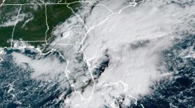
Category one Hurricane Arthur has maximum sustained winds of 80 miles per hour.
Hatteras Island residents have begun a mandatory evacuation this morning, and a State of Emergency has been issued for all of Dare County. Hyde County has issued a voluntary evacuation for Ocracoke Island for 2 p.m. today.
National Weather Service Meteorologist Lara Pagano said North Carolinians can expect to feel the effects of the hurricane's outer bands today.
“It's gonna seem like a typical thunderstorm, but more tropical in nature. You're gonna get some heavy rain,” Pagano said. “You really aren't gonna get the strong winds though until later on this evening until the overnight hours, and then into the early morning hours in the Northern Outer Banks.”
Pagano said residents of Dare, Hyde, Pamlico, Carteret and other coastal counties can expect rain and strong winds.
“The wind gusts could be 65-to-85 miles per hour, but those along the Outer Banks could see gusts up to 105 miles per hour.”
Pagano said people should reconsider before getting in any last-minute swimming, as rip currents are likely. There's a low threat of tornados, and a high likelihood of flooding. She warned that low areas could see surges up to five feet.


